it sounded so nice. a house on a hill overlooking the ocean on sunny south bruny island, south of the tassie (tasmanian) capital, hobart. a great year-end family getaway for the kids who are escaping from a bout of foul wintry weather in the northern hemisphere. you can’t get more southern than bruny, and at the height of summer to boot. pack yer shorts!
well, pack yer handkerchiefs and antihistamines.
don’t misunderstand. pernille has booked us just about the best place imaginable. a lovely, modern house on a hill overlooking the ocean. lots of sun. outdoor space. miles from the nearest neighbors. (we make a lot of noise with our incessant birdwatching.) it’s not far from the beaches (nothing is on bruny island), and there’s plenty of room for billabong, our border collie, to roam. only catch is, it’s surrounded by acres of alfalfa fields, and one of us — me — is deathly allergic to alfalfa (hay). yep, hay fever.
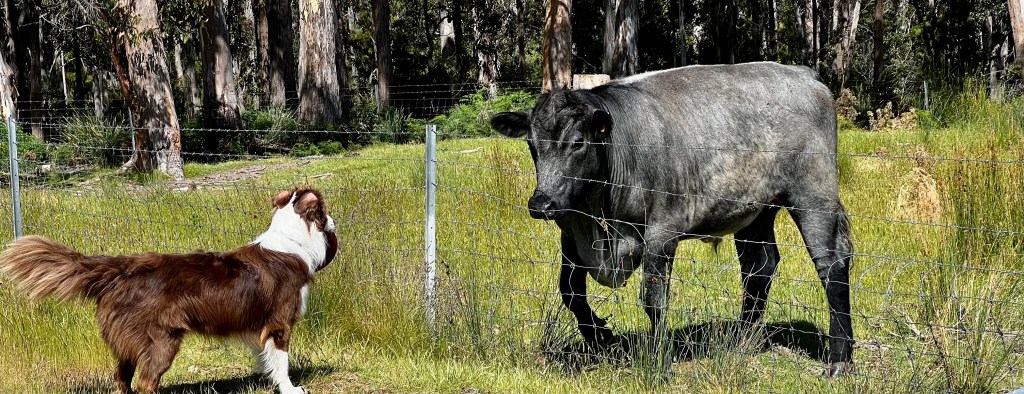
it follows, of course, that alfalfa fields are feeding grounds for farm animals, and our arrival must have been cause for great excitement in the neighborhood. minutes after we pulled into the driveway, a greeting committee trotted up to the fence in the form of a dozen big, black bulls, prompting an impromptu standoff between our self-styled herding dog billabong, who tips the scales at a mighty 22kg (almost 50 pounds), and probably about 30 tonnes of belligerent bovines.
a showdown was avoided thanks to a wire fence separating the driveway from the paddock. it was a close call, though. the fence runs just a few meters from our back porch, and billabong fancies himself a minder of grazing animals, never mind their own opinions on the subject.
to add insult to injury, while we were unpacking, a tractor pulled up at the hay field and our neighborhood farmer cut the mature hay down. we then learned about the phenomenon of the “roaring forties,” the winds that are a blot on tassie’s otherwise spotless reputation, as gusts of hayseed buzzed around the house all that evening and into the next several days, sending my allergies into orbit.
conspiracy, anyone, or just a coincidence?
anyway, enough of my whingeing.
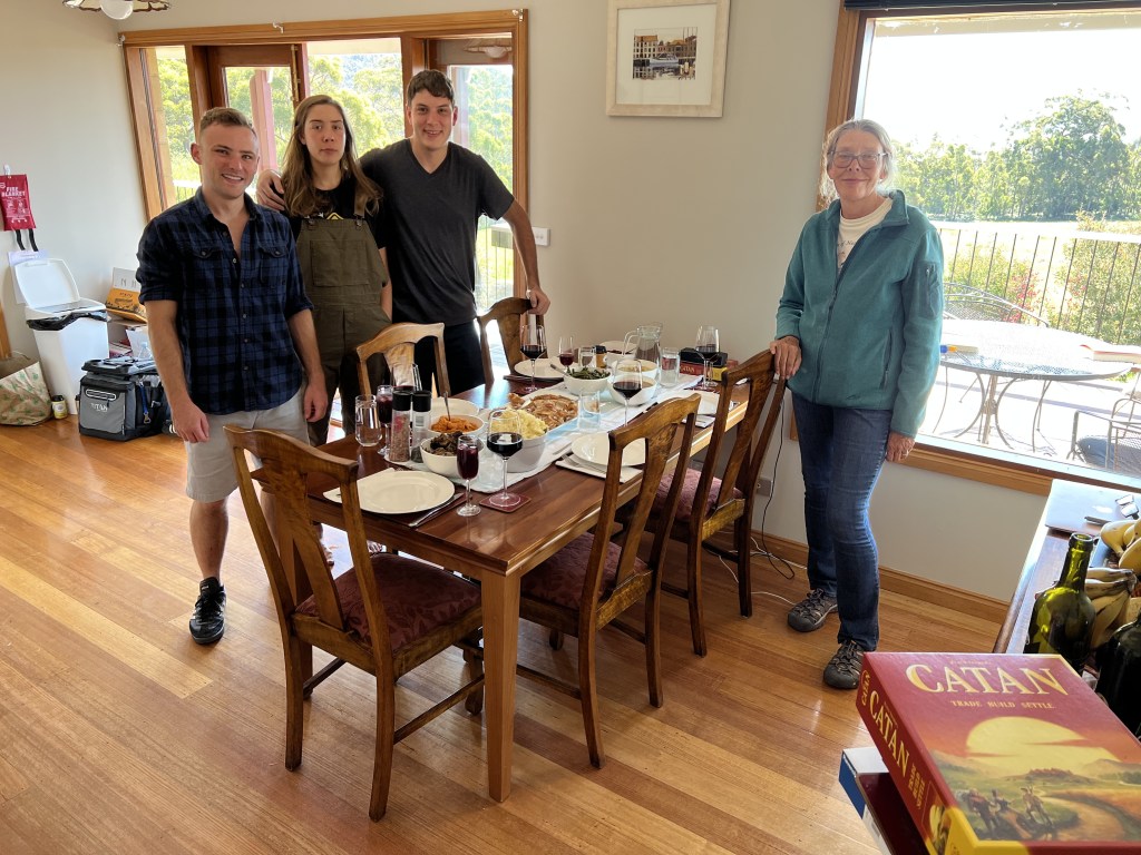
from L: family friend nathan stambaugh, laura (lopp), karl (moose) and pernille.
christmas dinner. a juicy ten pound turkey that, believe it or not, provided leftovers and turkey sandwiches for five people for days afterward. a “loaves and fishes” phenomenon that lasted until the final morsels of wing meat were dipped into a sea of sriracha mayo between two slabs of supermarket white bread and sandwichized on new year’s eve. NEW YEAR’S EVE! fer chrissakes! and it was dee-licious to the last bite of our final meal of the year. though to be truthful, the last bites were mostly sriracha mayo between the bread slices, with a hint of generic bird meat. miraculous.
(full disclosure: this wasn’t actually the ultimate meal of 2022. pernille prepared a champagne and lobster feast as the clock wound down toward the midnight hour. we never made it. (the lure of the pillow was just too powerful.)
for the rest of the family, it was almost two weeks of bliss; hiking the mountains around our house, exploring bruny island’s rocky coast, running, kayaking, oyster feasting, stargazing at the aurora australis (the southern hemisphere equivalent of the aurora borealis), chasing bulls (for one of us); in short, enjoying the moderate summer days and brisk island nights. for me, on the other hand, it was itchy eyes and soaked hankies until i was finally able to get medical attention after christmas in the nearby town of alonnah, which has a surprisingly well-equipped hospital for a population of probably no more than a couple thousand hardcore islanders.
2023 has dawned, and with it all the vagaries of aging as everyone gets — as the old tennessee ernie ford classic (“sixteen tons”) goes, — “another day older and deeper in debt.” the year 2022 saw a historic increase in mortality from all causes in australia and many other countries. my fervent wish is that all you reading this today are still around to check out the “end of 23” blog a year from now. we’re already planning another big tassie holiday bash, and i’ll do my best to be here to blog it.
we seen a croc ‘r two in kakadu, and they been seein’ us, too
on patrol in the yellow water billabong
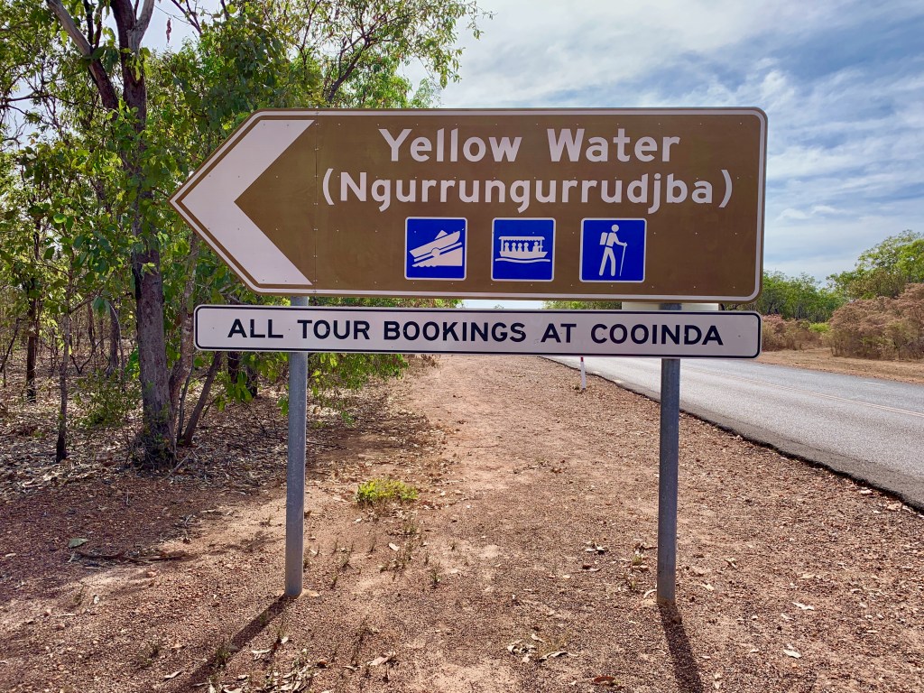
it took a while for us to figure it out. why would “yellow water” make the “must see” list of tourist attractions in australia’s northern territory ? “yellow water” sounds like a sewage pond.
certainly not a holiday to die for. maybe to die from.
my first thought when i saw the sign was, maybe it’s a warning. like “yellow fever region”? on second thought, maybe it’s a urinal, asking for contributions. maybe i could help out.
actually, the visit to yellow water, or ngurrungurrudjba in the language of the traditional owners of the land, the gagudju people, was possibly the highlight of our maiden visit to ‘the territory”. it’s a billabong in kakadu.
yep, ngurrungurrudjba is a billabong in kakadu. maybe a word of explanation is in order.
let’s take billabong first. it is several things. first, it’s an iconic aussie surfwear brand. it’s also a naughty four month old shoe thief who’s the newest member of the family.
billabong caught in the act
for our purposes here, though, billabong refers to the stagnant ponds that remain in river beds during the dry season, when the floodwaters recede. when the rains return, these billabongs overflow their banks and disappear into the flood plain that covers the lowlands.
yellow water billabong is part of the south alligator river system, a peculiar name since there are no alligators in australia. only crocodiles. in the dry season, it’s just a big croc pond.
the n.t. (northern territory) is mostly “m-t” (empty)
kakadu is australia’s largest national park, home to the gagudjus, a wandering tribe that has inhabited these lands since time immemorial. it is a 20,000 sq.km. treasure trove of waterfalls, rain forests, dramatic escarpments, aboriginal rock art, exotic bird life, and the yellow water billabong.
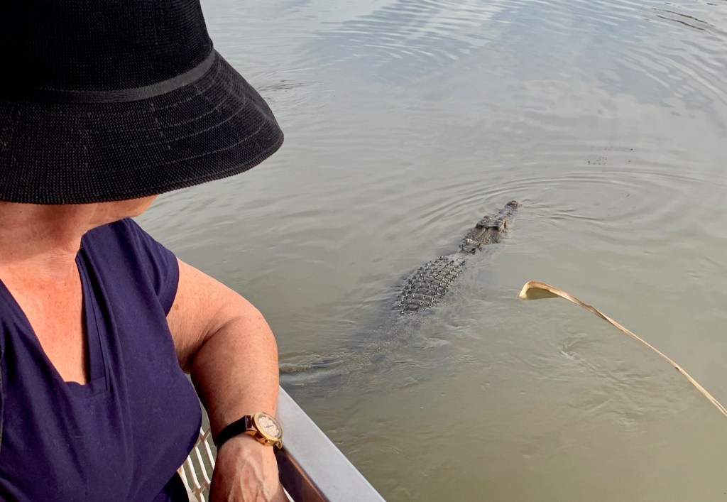
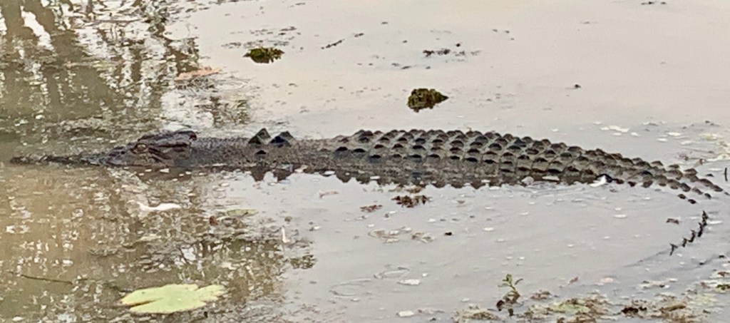
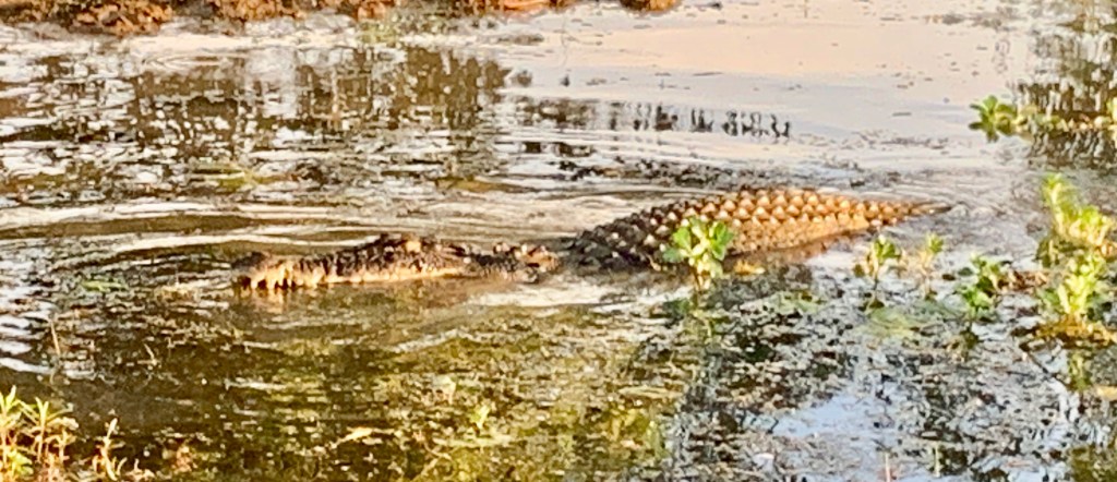
massive crocs glide by alongside cruise boats within arm’s length on the billabong, ready to snap off the limbs of anyone foolish enough to point. (“look ma, a crocodi…aaahh!”).
we were determined to see yellow water billabong even if we had to wear nose clips, because, frankly, we’d come for the birds. this billabong has been voted the #1 destination for birdwatching in oz! second place went to the alice springs sewage ponds in the southern northern territory, or “lower n.t.” in the local lingo. seriously!
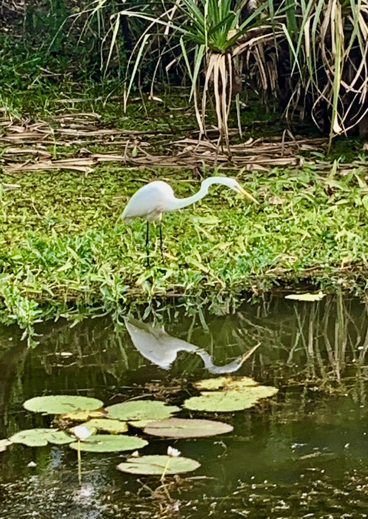
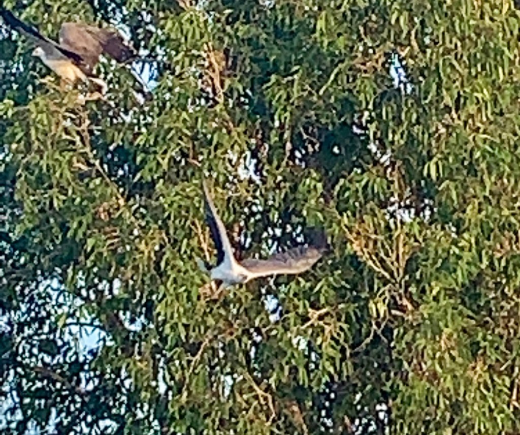
yellow water attracts roughly a third of australia’s 900 or so bird species. we saw white-bellied sea eagles, whistling ducks, white egrets, pied herons, magpie geese, night herons, azure kingfishers, black-necked storks and comb-crested jacanas, to name a few.
the birds were great. don’t misunderstand. but it’s a challenge to snap a high-resolution photo of a bird at 100 meters with the average cell phone camera. on the other hand, photographing a croc looking you straight in the eye presents the opposite challenge. it’s hard to fit them in the frame. you snap them, they snap you.
this 15 ft. (nearly 5 meter) croc kindly swishes his tail so it will fit in the frame
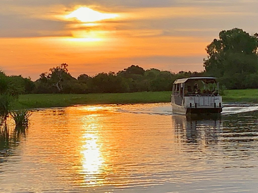
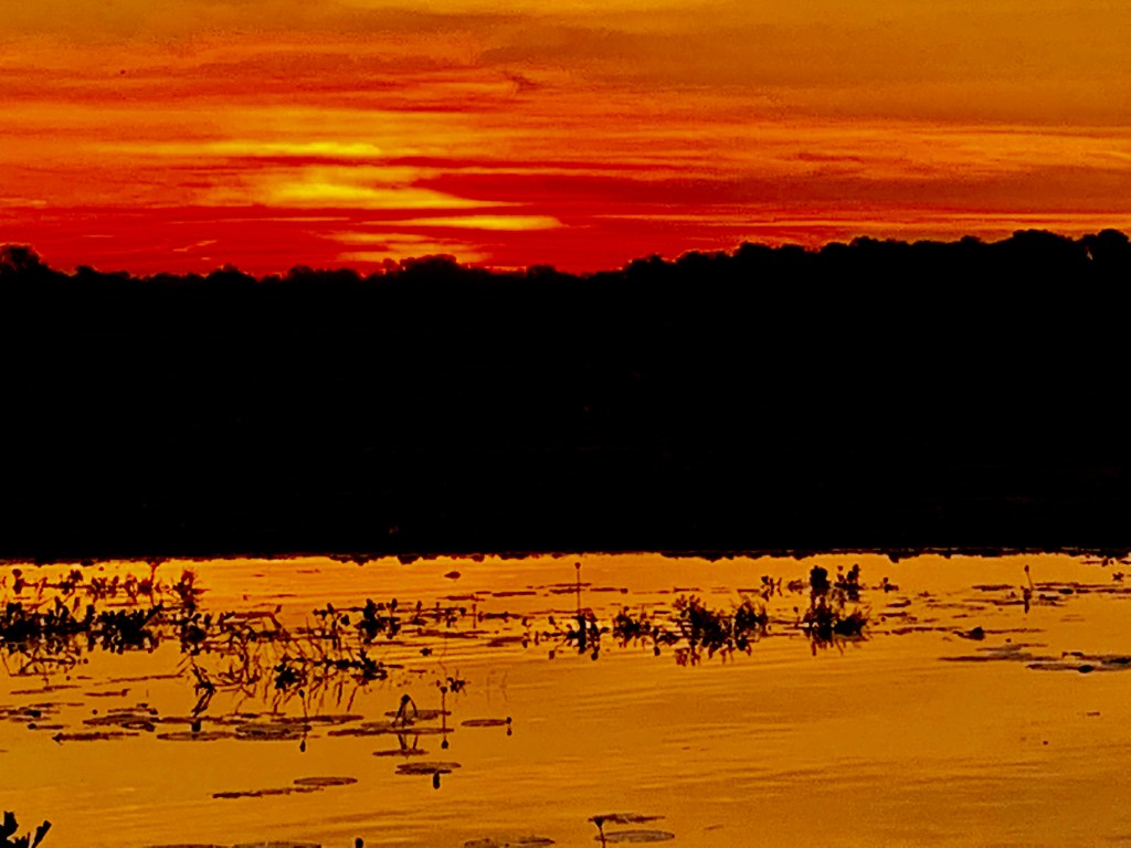
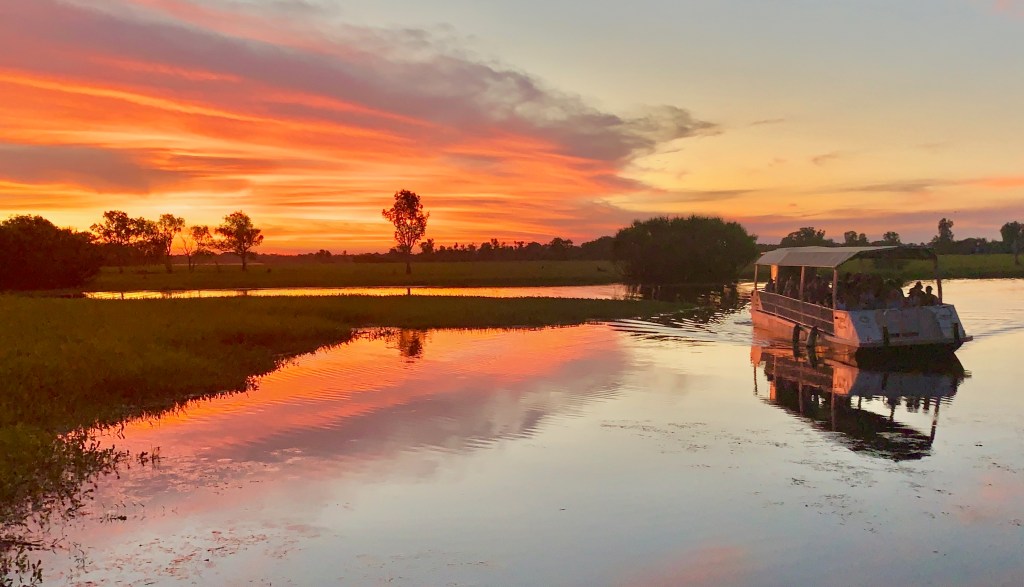
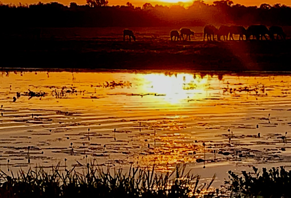
we had booked a sunset cruise at yellow water, then returned before dawn the following morning for a sunrise encore. both were excellent, but something was troubling. the birds were plentiful, the crocs suitably sinister, the weather ideal, the guides informative, the sunrise and sunset magnificent. but the water? yes, it was putrid. but it was… dull as recycled cardboard. a crocodile camouflage gray. what were we missing?
what had the gagudjus (pron: ‘ga-ga-jews) seen that we weren’t seeing? it was a real head scratcher. we didn’t get it until we returned home and downloaded our photos. there it was! yellow water! we’d seen the trees and missed the forest.
a cruise vessel on yellow water billabong at sunrise
the gagudju people had known what they were talking about. we’d been too busy looking at birds and crocs and water buffalo to notice the “ngurrungurrudjba”. duh!!
most of the day, yellow water billabong water is just a mud puddle crawling with creepy man-eating reptiles. but at dawn and dusk, it transforms into a golden pond crawling with creepy man-eating reptiles.
in our defense, we were only there two nights. for the gagudjus, this is the promised land. they know it intimately.
which comes first, human safety or crocodile safety?
they may not look gagudju-ish, but they’ve been wandering the desert and fishing this billabong for thousands of years.
and sure enough, the waters do part each year, allowing the tribespeople to walk across the sea bed, in keeping with oral tradition.
there’s no clear record of how the gagudjus coexisted with the crocs, who were probably there first. but the gagudjus live in harmony with the environment, which in the top end includes tropical heat, torrential rains, annual floods, (and no internet).
without a written language, the gagudju people passed down from generation to generation highly localized knowledge of weather and climate patterns. they identified six distinct seasons that are particular to the yellow water region.
the most welcome time of year they call yucky, spelled “yekke”, which ushers in the cool, dry months when the waters recede and the “balanda” (the gagudju-ish word for gentiles) arrive in their campers to inject a little cash into the local economy.
in contrast, the “balanda”, who stay mostly in darwin, observe just two seasons in the top end, which they call “the wet” and “the dry”. they also note the brief interim period when lightning storms illuminate the night sky to herald the change of seasons.
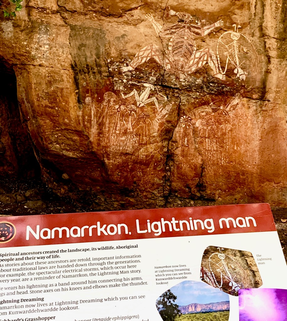
in gagudju lore, a powerful creation ancestor called namarrkon the lightning man shoots down from the heavens on a bolt of purple-white light with thunderous fanfare to deliver relief from the heat.
that’s namarrkon, at the top right of the wall painting
during “the dry”, the gagudjus camp mainly in the floodplain; but to paraphrase a line immortalized in song by two members of “the tribe” (lerner and loewe), “the rain, as in spain, stays mainly in the plain”, so during the rainy season the gagudjus move up to the stone country for shelter.
also, there ain’t no crocs in the rocks.
a painting in the park depicting an indigenous family on the move
before the balanda began settling the top end nearly two centuries ago, (mostly the west bank of the alligator river), the population of what is now kakadu national park was about 2000 people. that number has since dwindled to about 500, who maintain the sacred sites and preserve their ancestral culture.
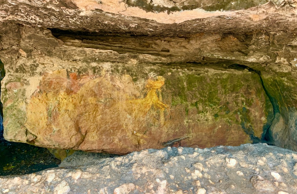
their mission includes preserving one of world’s greatest concentrations of rock art. some paintings are as much as 20,000 years old, making this one of the longest historical records anywhere.
nym djimongurr, photograph by valerie ihuede, c. 1970
many of the 5,000 artworks were spruced up and repainted by clan elders in a restoration project in the mid 20th century, as kakadu was coming to international prominence. much of the work was done by nym djimongurr, (pictured here), an elder who left behind a living record of his knowledge of gagudju-ish humor, stories and customs that provides visitors today with insights into bininj culture.
kakadu became a national park in 1979. in 1981 it was added to the list of world heritage sites. the unesco proclamation notes that kakadu:
“provides a window into human civilization in the days before the last ice age (and) reveals insights into hunting and gathering practices, social structure and ritual ceremonies of indigenous societies from the pleistocene epoch.”
almost any list of oz’s best national parks will rank kakadu #1. but it’s far from the most visited park. the most popular are those closest to sydney and melbourne. both have 20 times the population of the entire n.t.
like most of the top end, kakadu is practically “m-t”. “the territory” boasts a population density of about one person for every five square kilometers, most of them in darwin. by contrast, australia’s most densely populated region, the capital territory (canberra), has 150 people per square kilometer. (canberrans are quite dense.)
to understand just how remote the top end is, darwin is roughly a 45 hour drive (not minutes, hours) from any of australia’s big cities. it’s closer to jakarta than to sydney. getting to kakadu from sydney means a 4 ½ hour flight to darwin, then another three hours by car. so if you go, you can be pretty sure it won’t be crowded. (unless this blog post goes viral)
sunset from darwin’s bicentennial park overlooking the harbor
as a bonus, you can spend time in darwin, australia’s gateway to asia.
darwin’s status as a territorial capital is unique the n.t. is less autonomous than the country’s six states, and the people don’t seem to mind, partly because it’s virtually m-t, so there’s hardly any taxpayers. territorial status provides the n.t. most of the same rights and privileges as the states, but their administrative budget comes from the federal government. so by declining statehood, territorians can do whatever they please and let the feds foot the bill. they’re not that dense.
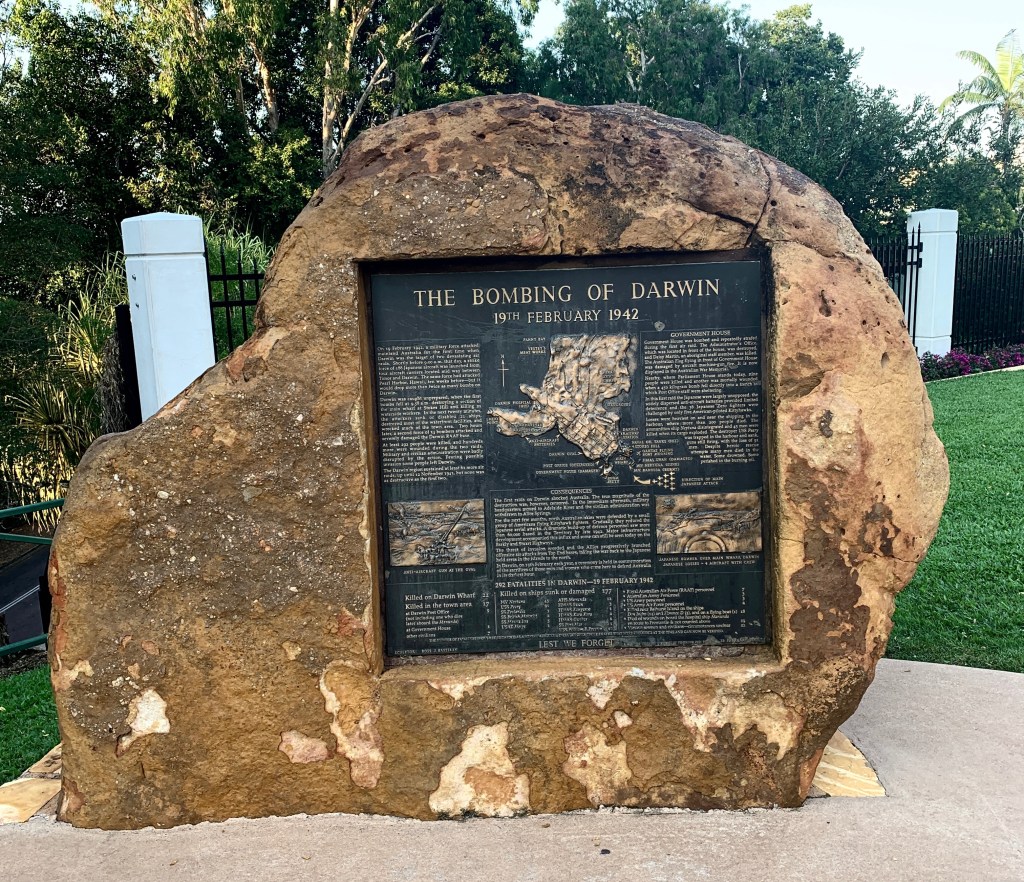
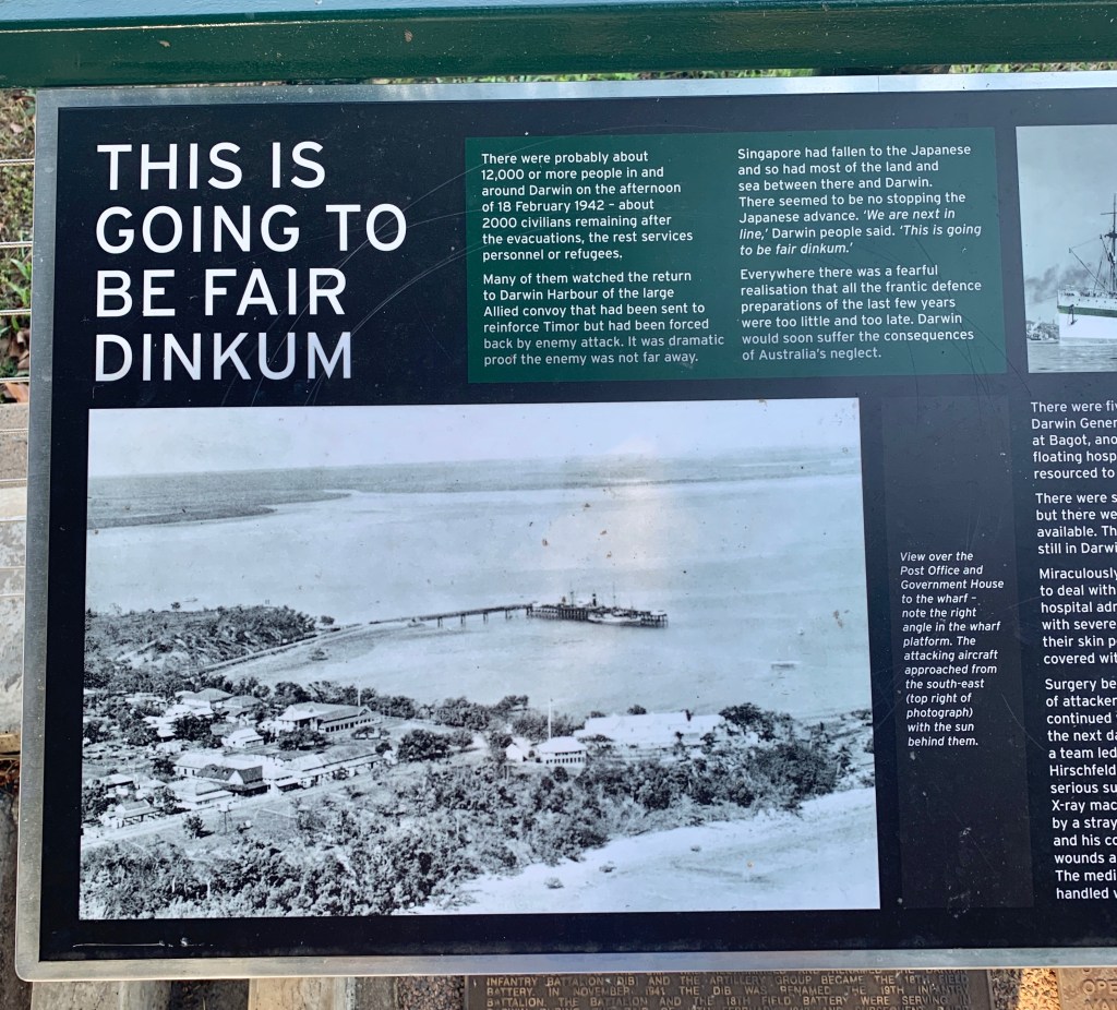
darwin is unusual in another respect. it’s been bombed. many times. it may be remote, but it’s strategically located on the timor sea. the same japanese planes that hit pearl harbor in december, 1941 turned their sights on darwin ten weeks later. they dropped twice as many bombs in the february 19, 1942 raids, killing 252 people. (damn near everybody there)
japanese bombers struck darwin 62 more times over the next 20 months.
the cenotaph war memorial at darwin’s bicentennial park
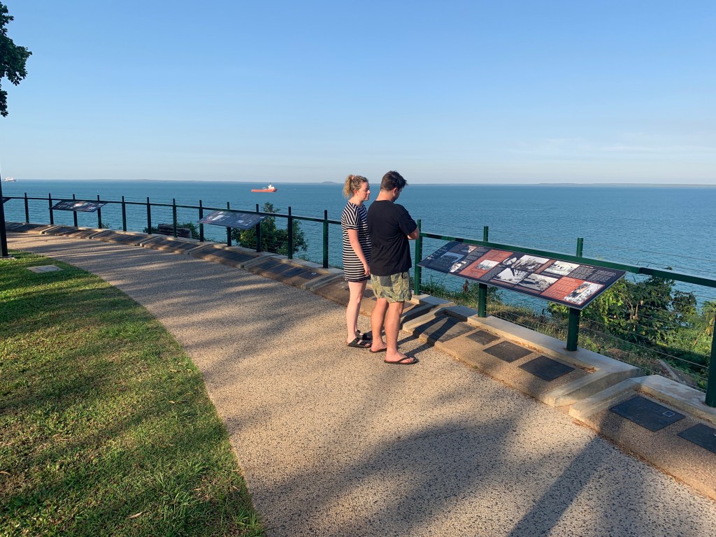
that bleak period is memorialized in a graphic display along the waterfront overlooking darwin harbor, where the bombs hit hardest. the city’s bicentennial park showcase the hardships endured during the period when all darwinians had one ear cocked for the sickening hum of incoming bombers.
it was “fair dinkum”, the locals said. “fair dinkum” is a catch-all aussie slang term. in this case, it seems to mean “this is not going to be pretty”.
darwin’s wartime history is outlined in a series of installations along the waterfront that bore the brunt of the bombs
bicentennial park serves as a reminder of darwin’s strategic importance, both in past military encounters, such as with japan, and the present, as the nation responds to an increasingly assertive china, which sees its backyard extending all the way to the australian shoreline.
the eternal flame in bicentennial park
darwin is, however, quintessentially aussie, as in directionally challenged. just as the australia’s south coast is on the east coast, the western most spot in the city of darwin is called… wait for it… east point.
that pales in comparison to what almost was. when australia became a federation in 1901, the north was part of the south. no one seemed to think it odd that south australia extended all the way to the north coast. eventually the southerners begged to be relieved of responsibility for the northern half because they couldn’t afford to administer it. there were no taxpayers there.
imagine the north coast being in the south
that’s it for year one. year two of the aussie adventure promises more road trips, as we’ve finally received our car. (it’s a beast) also, expect more adventures of billabong. he’s already practicing croc hunting.
billabong the croc hunter with his “catch”
we hope to include (covid permitting) a trip to uluru, in the southern northern territory. as the irreverent tourism slogan goes, see you in the n.t.